Sometimes it takes an elevated view to appreciate the big picture.
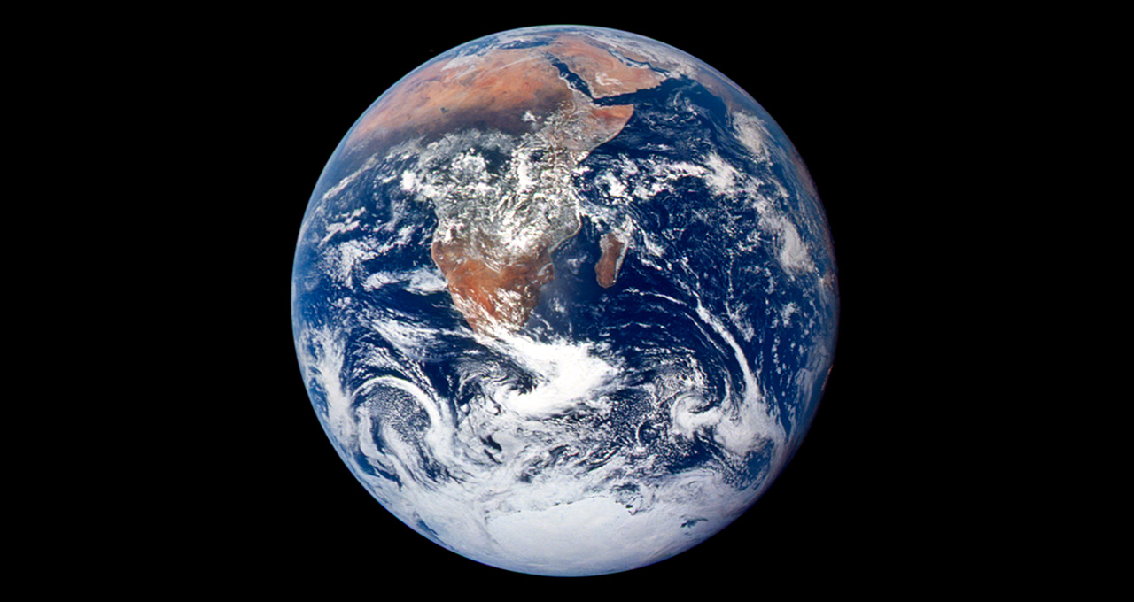
NASA’s iconic “Blue Marble,” taken in 1972, helped inspire the modern environmental movement by capturing the finite and fragile nature of Earth for the first time. Today, aerial imagery from satellites and drones powers a range of efforts to monitor and protect our planet — accelerated by AI and NVIDIA GPUs.
On the 50th anniversary of Earth Day, see how companies in the NVIDIA Inception program are using aerial imagery and AI to track global deforestation, monitor thawing permafrost in the Arctic and prevent natural gas leaks.
Inception is a virtual accelerator that equips startups in AI and data science with fundamental tools to support product development, prototyping and deployment.
Tracking Tree Loss: Orbital Insight
Millions of acres of forests are lost each year due to agriculture and illegal logging. Orbital Insight is working with the World Resources Institute to identify areas around the world where virgin rainforest is being replaced with new roads, buildings and palm oil plantations.
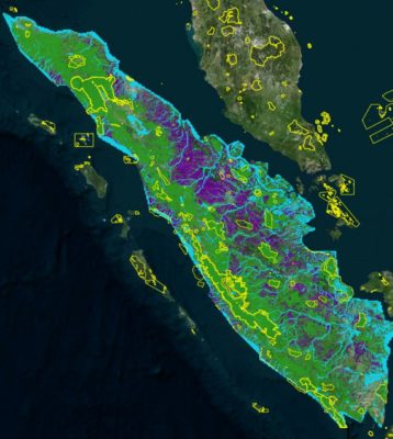
Using over 600,000 five-meter resolution satellite images, the startup’s deep learning algorithm maps deforestation as part of Global Forest Watch’s initiative for real-time forest monitoring. AI can give researchers a head start, allowing them to spot signs of impending deforestation by extrapolating trends into the future — rather than relying on monthly alerts that come too late to prevent tree loss.
The tool can also help companies assess the risk of deforestation in their supply chains. Commodities like palm oil have driven widespread deforestation in Southeast Asia, leading several producers to pledge to achieve zero net deforestation in their supply chains this year.
Based in Palo Alto, Calif., Orbital Insight uses convolutional neural networks to analyze satellite imagery and radar data for supply chain monitoring, real estate, mapping and infrastructure. Its geospatial AI algorithms are accelerated by NVIDIA GPUs through Amazon Web Services.
Using GPUs in the cloud allows the team to upscale and downscale their usage as needed, and enables a 100x inference speedup on huge satellite images, said Manuel Gonzalez-Rivero, senior computer vision scientist at the company.
AI on the Arctic: 3vGeomatics
One of the biggest burgeoning climate threats today is thawing permafrost. Mainly found in polar regions like the Canadian Arctic, permafrost is composed of ice, rock and sediment located under a layer of soil. Rich in organic material, the world’s permafrost is estimated to contain 1,500 billion tons of carbon — twice as much as in the Earth’s atmosphere.
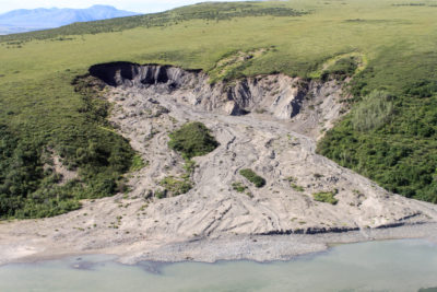
As much as 70 percent of permafrost could melt by 2100, releasing massive amounts of carbon into the atmosphere. Climate change-induced permafrost thaw also causes landslides and erosion that threaten communities and critical infrastructure.
Through a project for the Canadian Space Agency, Inception startup 3vGeomatics is using a remote sensing radar satellite-based technology called InSAR to monitor thawing permafrost across the Canadian Arctic.
Conducting analyses via an on-premises server with dozens of NVIDIA data center GPUs enables thousand-fold increases in processing speed of the radar satellite images, each of which contains billions of pixels and covers thousands of square kilometers.
“Before, it would take months to analyze satellite images and deliver results, only to tell our client that they had a landslide 5 weeks ago,” said Parwant Ghuman, chief technology officer of 3vGeomatics. “Leveraging GPUs enables us to deliver actionable intelligence about the risks they have today.”
Preventing Oil, Gas Leaks: Azavea
The U.S. oil and gas industry leaks an estimated 13 million metric tons of methane into the atmosphere each year — much of which is preventable. One of the leading sources is excavation damage caused by third parties, unaware that they’re digging over a natural gas pipeline.
Azavea, a Philadelphia-based startup that builds geospatial analytics tools for civic and social impact, is collaborating with aerial services company American Aerospace to detect construction over known pipelines — using NVIDIA GPUs for training as well as inference at the edge.
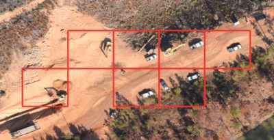
Neural networks deployed on planes or drones can detect visible construction vehicles and trucks on the ground, warning oil and gas companies of potential excavations that could damage pipelines.
“Currently, a pilot will just fly at low altitudes over known pipelines and look out the window to see if there’s any indication of construction vehicles,” said Rob Emanuele, vice president of research at Azavea. “Our work allows pilots to fly much safer by flying higher off the ground, relying on AI to detect where construction vehicles are present.”
Developed with Raster Vision, Azavea’s open-source deep learning framework for aerial imagery, the AI algorithms are being tested using an NVIDIA RTX laptop in a small plane for real-time inference. Future deployments would instead use embedded GPUs on unmanned aircraft and drones.
Learn more about how GPU technology is driving applications with social impact, including environmental projects.
Main image credit: NASA